Shahbuz District (Shahbuz Rayon)
Shahbuz District (Şahbuz rayonu) is one of the 7 districts of the Nakhchivan Autonomous Republic of Azerbaijan. The district borders the districts of Julfa, Babek, and the Syunik and Vayots Dzor provinces of Armenia. Its capital and largest city is Shahbuz. As of 2020, the district had a population of 25,300.
Covering 27 villages and plateaus of the Oyuqlucaqaya, Bazaryurd, Dərəbash, Qachdash, Nərkechi and Armudlu, the region of Dərəşahbuz was established in the 16th century and functioned up to 40th years of the 19th century. In 1925, it was named Narimanov District in the administrative-territorial unit of Nakhchivan (encompassing 30 villages) and renamed Shahbuz in 1930. In 1963, the district was abolished and given to the Nakhchivan (since 1978, Babak) region; Shahbuz has operated as an independent district since 1965.
In 2007, the settlement of Shahbuz was given city status. In 2013, by decree of President of Azerbaijan Republic, Qarababa village was dissolved and added into the administrative territory of the city of Shahbuz.
Shahbuz district is located in the north of NAR. It is a mountainous area. Salvarti (3162 m), Uchgardash (3156 m), and Kechaldagh (3115 m) are the highest points. Like the rest of the republic, many groundwaters flow in the region, such as badamli, batabat, caravansarai, bichanak and other mineral waters. There are sulfur, construction materials, peat deposits. The district has the river Nakhchivanchay River and its tributaries - Kuku, Shahbuz, Salvarti - and Ganligol and Batabat Lakes. "Badamli" resort was built near the Badamli mineral water plant.
Map - Shahbuz District (Shahbuz Rayon)
Map
Country - Azerbaijan
 |
 |
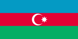
| Flag of Azerbaijan | |
The Azerbaijan Democratic Republic proclaimed its independence from the Transcaucasian Democratic Federative Republic in 1918 and became the first secular democratic Muslim-majority state. In 1920, the country was incorporated into the Soviet Union as the Azerbaijan SSR. The modern Republic of Azerbaijan proclaimed its independence on 30 August 1991, shortly before the dissolution of the Soviet Union in the same year. In September 1991, the ethnic Armenian majority of the Nagorno-Karabakh region formed the self-proclaimed Republic of Artsakh. The region and seven surrounding districts are internationally recognized as part of Azerbaijan pending a solution to the status of the Nagorno-Karabakh through negotiations facilitated by the OSCE, although became de facto independent with the end of the First Nagorno-Karabakh War in 1994. Following the Second Nagorno-Karabakh War in 2020, the seven districts and parts of Nagorno-Karabakh were returned to Azerbaijani control.
Currency / Language
| ISO | Currency | Symbol | Significant figures |
|---|---|---|---|
| AZN | Azerbaijani manat | ₼ | 2 |
| ISO | Language |
|---|---|
| HY | Armenian language |
| AZ | Azerbaijani language |
| RU | Russian language |


